
On This Page
Study Summary and Goals
The main purpose of the International Management District Livable Centers’ study for the International Management District is to address the following challenges:
- An auto-dominated infrastructure;
- Superblocks and suburban trip retail development patterns in the District;
- Lack of unified community identity and investment throughout the area;
- Lack of safe access to existing transit; and
- Lack of central community cores.
The desired end goal of the Study is to provide the District with implementable recommendations to:
- Identify and market local and regional destinations in the District to the greater Houston area;
- Provide better access and connectivity to and within the District;
- Establish first and last mile connections throughout the District;
- Break up superblocks in the District;
- Close gaps in the pedestrian/bicycle network in the District;
- Diversify housing stock and employment opportunities in the District;
- Incorporate wayfinding and streetscape enhancements throughout the District; and
- Celebrate cultural diversity in the District.
Received 2020 Silver Planning Achievement Award in Public Outreach from the Texas Chapter of the American Planning Association (APATX).
Study Area Map
The International Management District is located in the Alief area west of the Sam Houston Parkway (Beltway 8), south of the Westpark Tollway, east of State Highway 6, and largely north of the boundary between Harris County and Fort Bend County. The focus of the International Management District Livable Center study is the physical portion of the International Management District located within the city limits of Houston
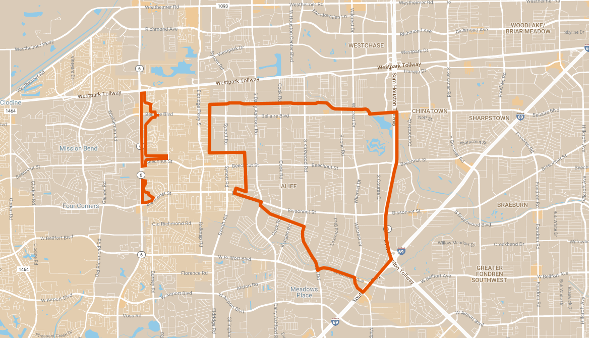
Click for a full size version of this map.
Local Partners
International Management District
Lead Consultant
Stantec