 713-627-3200


On This Page
Summary and Goals
Many residents of communities proximate to the study area are experiencing rapid displacement, a trend particularly acute in the Third Ward, Second Ward, and Fifth Ward. While South Downtown has gained approximately 4,000 new housing units in recent years, this growth has not necessarily addressed the need for housing for workforce and low-income individuals and families. With available infrastructure and underutilized land, South Downtown and North Midtown together have the potential to help close the affordable housing gap in Houston's inner core, particularly as the potential decommissioning of the Pierce Elevated as part of the North Houston Highway Improvement Project (NHHIP) could unlock significant acreage for new mixed-income development.
With an increase in residents comes the need for connectivity among area activity centers. Despite a strong multimodal foundation, pedestrian infrastructure lags, hindering east-west connectivity and access to amenities within Downtown and Midtown and to adjacent neighborhoods including EaDo, Third Ward, and Second Ward. As a result, the area struggles with a lack of street-level vibrancy. Connections between South Downtown and North Midtown in the form of street grid connections, green space, and mixed income development have the potential to stitch the two areas together as a more cohesive urban district. Enhancing residents' ability to navigate the study area on foot and by other multimodal means will improve their access to workplaces, schools, healthcare, grocery stores, and recreational amenities. Additionally, the study will identify ways to integrate green spaces such as Trebly Park, Discovery Green, Bagby Park, and Midtown Park into a connected active transportation network, fostering interaction and well-being for the community. The NHHIP, and particularly the potential decommissioning of the Pierce Elevated, presents a generational opportunity to enhance both South Downtown and North Midtown through additional green space, recreational facilities, and mixed-use developments that include affordable housing options, while also restoring neighborhood connectivity in North Midtown that was severed by the original highway construction.
Overall, the South Downtown/North Midtown Livable Center study aims to spur affordable housing development, enhance multimodal and pedestrian connectivity, expand green spaces, and encourage mixed-use development to create a vibrant, walkable environment that attracts residents and businesses alike.
Study Area Map
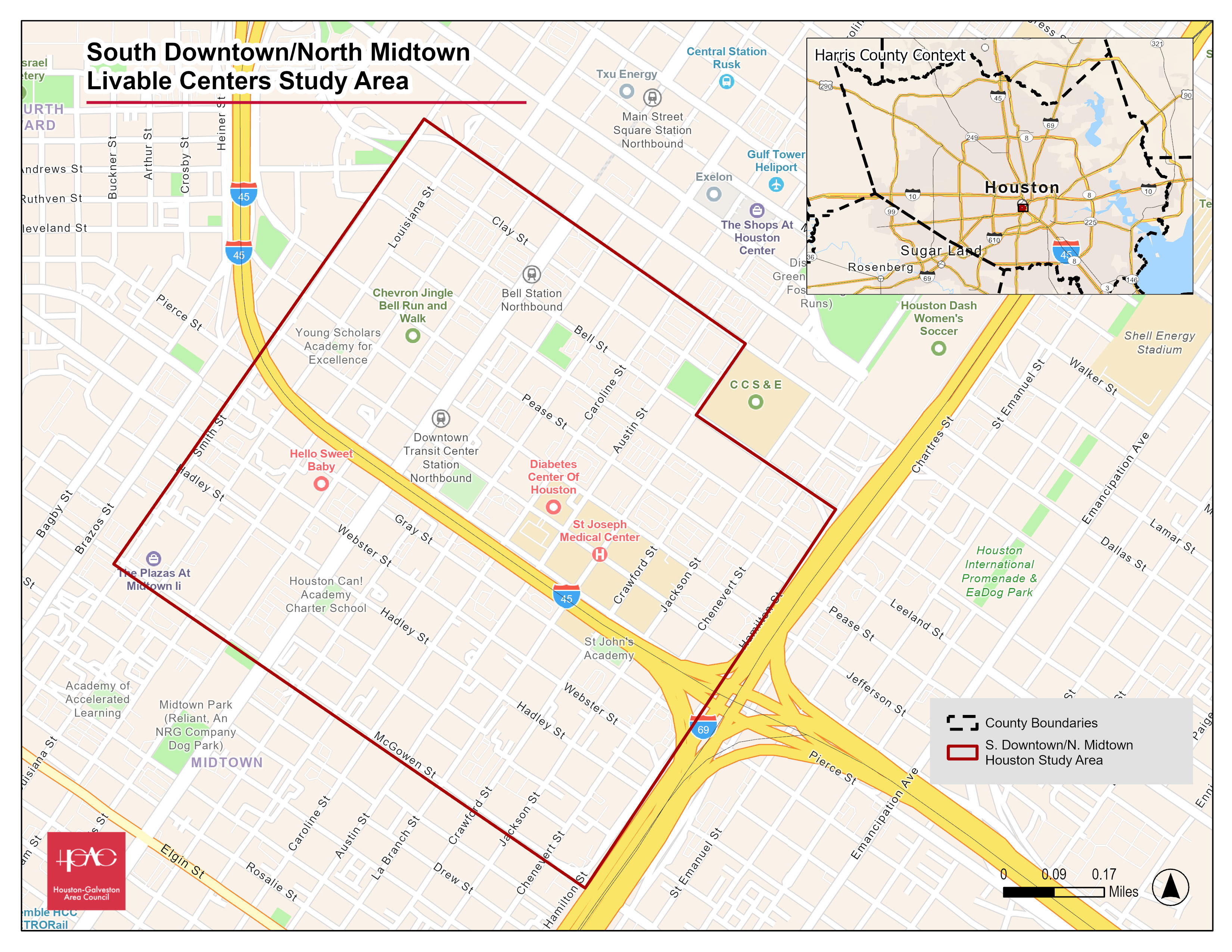
Click for a full size version of this map.