
On This Page
Summary and Goals
The Fresno Livable Centers Study aims to spur public and private investment in an area that has been otherwise overlooked by the private sector due to complex development constraints. With proactive and creative planning, Fresno has the potential to become a truly Livable Center. Fort Bend County, alongside its partners, is committed to addressing the area’s challenges—but a comprehensive action plan is needed to ensure transformative, sustainable, and inclusive growth for current residents.
Fresno faces significant infrastructure deficiencies, including narrow roadways that lack sidewalks, frequent dead ends, and limited connectivity. The community is bisected by a railway and situated near a landfill and Houston Southwest Airport. Many areas still lack access to water and wastewater services, while Mustang Bayou poses a flood risk. Recreational opportunities are also limited, with only one park in the southeast, accessible only by car. Additionally, poor historical lot and parcel layouts create further barriers to large-scale redevelopment.
A key objective of this study is to identify strategies to better connect Old Fresno and New Fresno, bridging the gap between older linear developments and newer subdivisions. By identifying opportunities to enhance infrastructure, multimodal transportation options, and equitable connections between activity centers, the plan will ensure Fresno evolves into a resilient, high-quality community where people can live, work, and play.
Study Area Map
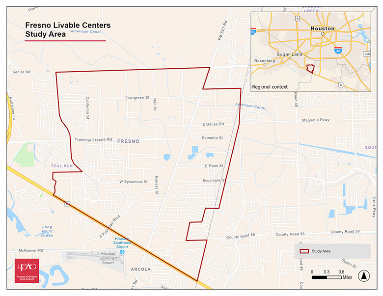
Click for a full size version of this map.
Local Partner
Fort Bend County Precinct 2
Lead Consultant
Consor Engineers