
On This Page
The Houston-Galveston Area Council is working with stakeholders in the Bessie's Creek Watershed to improve water quality by characterizing, identifying bacteria sources, and developing a TMDL (Total Maximum Daily Load) for the watershed.
Upcoming Activities
Bessie's Creek Watershed Public Meeting
Date and Time
Thursday, February 19, 2026
2 PM to 4 PM
Location
Simonton Community Church
9703 FM 1489
Simonton, TX 77476
This meeting is in person only.
Please join us for a Bessie’s Creek Watershed stakeholder/public meeting. This watershed includes Brookshire Creek. We will discuss water quality within the watershed, including concerns, impairments, and opportunities to improve.
Watershed Characteristics
The Bessie’s Creek watershed covers 106.49 square miles of rural and developing land within Waller and Fort Bend counties. The watershed inhabits the Gulf Prairies and Marshes Ecoregion.
Much of the watershed is used for agricultural production, particularly livestock grazing. The cities of Brookshire and Fulshear are the largest within the watershed, which also includes Simonton and Pattison and the town of Monaville. Like much of the outer Houston Region, the watershed is in transition with new roads and subdivisions, serving a growing population. The eastern portion of the watershed has seen the largest increase in suburban development, particularly within the cities of Brookshire and Fulshear.
About the Project
Streams and tributaries within the Bessie’s Creek watershed face potential water quality challenges like many Houston area waterways including contact recreation impairments due to elevated bacteria concentrations. Low dissolved oxygen levels, elevated nutrient concentrations and Chlorophyll-a are also concerns and could impede the waterway’s ability to support its designated uses.
Because of these water quality issues, the Houston-Galveston Area Council (H-GAC) was tasked by the Texas Commission on Environmental Quality (TCEQ) to draft a Watershed Characterization Report and Technical Support Document to assess the status and potential means to address water quality challenges in the creek. This approach sought to quantify and describe water quality trends, identify potential sources of pollution (particularly fecal bacteria) and develop information on which to base decisions about future approaches to improving water quality.
Additionally, the next steps include public outreach to inform local stakeholders and seek feedback on subsequent steps of addressing water quality in the watershed. This will be followed by the development of a TMDL study and subsequent Implementation Plan, with the potential for developing a locally led watershed protection plan (WPP) to address additional stakeholder and TCEQ-identified water quality concerns.
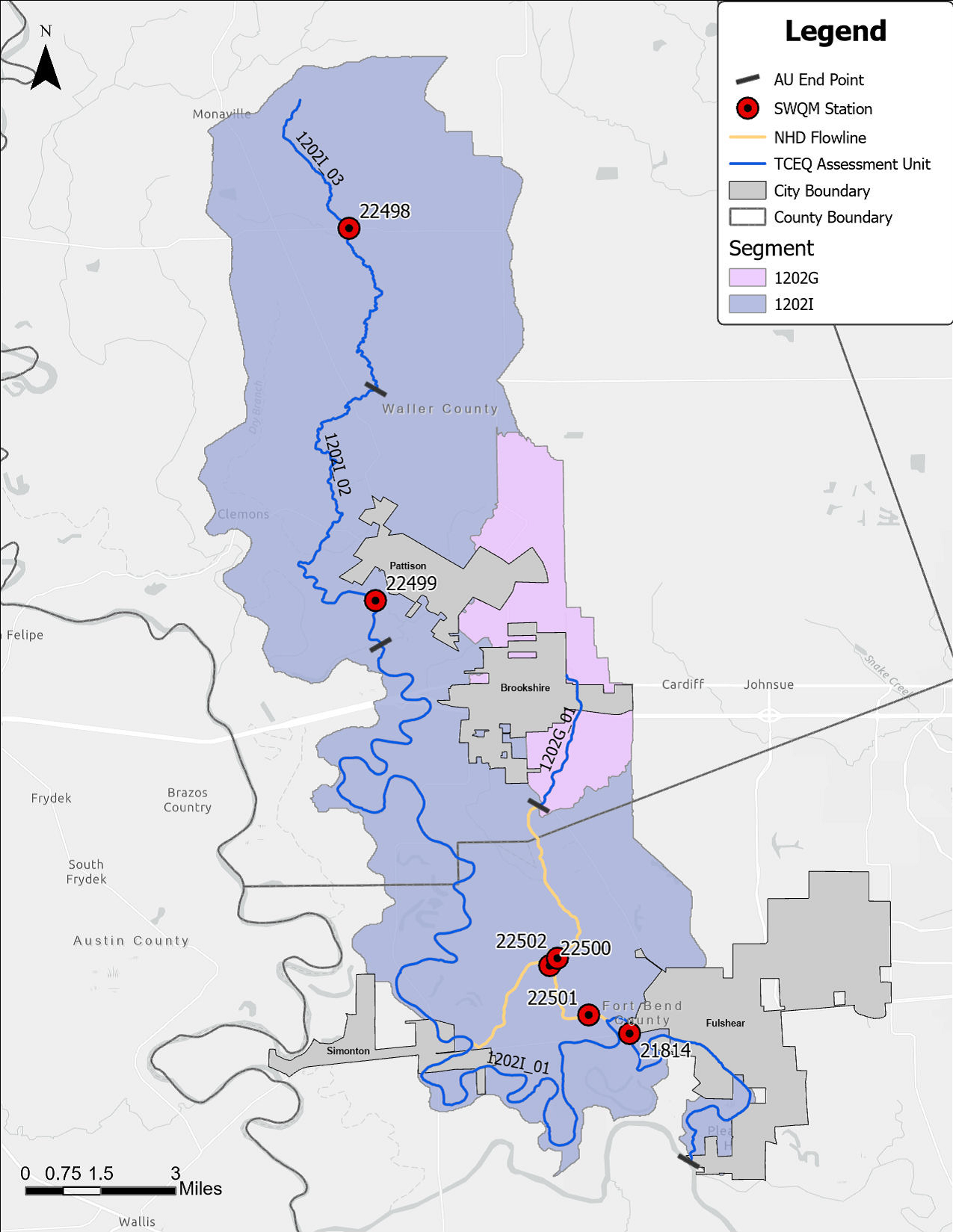
View full sized image.