On This Page
Aug 12, 2025
HOUSTON, TX – Michael Lambert, emergency preparedness and homeland security planner at the Houston-Galveston Area Council (H-GAC), shared firsthand lessons from Hurricane Katrina and its aftermath during a panel hosted by the Houston-Galveston Region Public Information Officer Network. The event took place at the Texas Department of Transportation’s Houston headquarters on Thursday, July 17, 2025.

From left, Karen LaFleur (APIO, Pool Coverage), Michael Lambert (APIO, Media Credentials and Media Monitoring), Joe Laud (Houston Emergency Center), Patrick Trahan (George R. Brown Convention Center's JIC member), USCG CDR Joe Leonard (Unified Area Commander), Francisco Sanchez (PIO Harris County Office of Homeland Security & Emergency Management) and Chuck Wolf (Deputy PIO & JIC Manager), pose with Johnny Morales (Houston/Galveston PIO Network) after receiving recognition for their service and dedication to the industry Thursday, July 17, 2025, at the Texas Department of Transportation headquarters in Houston. – Courtesy of Public Information Officer Network

Back row, from left: Michael Lambert, unidentified, Doug Ross, and Francisco Sanchez. Front row, from left: Sheila Sorvari, Chuck Wolf and unidentified person at the Joint Information Center in the Houston Astrodome in September 2005. – Courtesy of Chuck Wolf and Harris County
A Defining Moment for the Region
The year 2025 marks the 20th anniversary of Hurricane Katrina—a catastrophic event that devastated New Orleans on August 29, 2005, and triggered the relocation of more than 250,000 Louisiana residents to the Houston-Galveston region.

Floodwaters cover much of New Orleans in the aftermath of Hurricane Katrina. – NOAA, public domain
On August 31, Houston was given just 24 hours to prepare shelter space for 75,000 evacuees — including 25,000 who would arrive at the Astrodome, where Lambert served as an assistant public information officer.
“These folks had just lived through a major hurricane,” Lambert said. “Then, only a few hours later, they were faced with catastrophic flooding as the city’s levies gave way. Everything they had, they lost. Families were divided. Then they went through three to four days of deprivation in the Louisiana Superdome before being put on a bus with no idea where they were going.”

Hurricane Katrina survivors from New Orleans arrive by bus at a Red Cross shelter in the Houston Astrodome on Sept. 1, 2005. – FEMA, public domain
When evacuees arrived at the Astrodome, they were immediately triaged by medical teams and provided access to showers, clean clothes, and donated essentials. Lambert worked out of the Joint Information Center during the shelter operation, which lasted until September 20.
Then Came Rita
Just as the region began to recover from Katrina, another historic storm approached. On September 21, 2005, Hurricane Rita triggered the largest evacuation in U.S. history. An estimated 2.5 to 3.7 million people fled the Houston area and Gulf Coast, many fearing a repeat of the devastation in New Orleans.

Residents evacuate Galveston County on Sept. 21, 2005, as Hurricane Rita approaches. – FEMA, public domain
The result was gridlock. Traffic stalled for 18 to 30 hours, stranding drivers in triple-digit heat with limited fuel, food, and emergency services. At least 107 people died during the evacuation—many from heat exhaustion, medical equipment failure, or the inability to access care. One of the most tragic incidents occurred when a bus carrying nursing home residents caught fire, killing 23 people.
Although the Astrodome’s Katrina evacuees had already been resettled or flown to Fort Smith, Arkansas, Hurricane Rita made clear how unprepared the region was to evacuate its own population. The tragedy sparked urgent action to close gaps in planning and coordination.

A gas station in Magnolia, Texas, is overwhelmed with evacuees during Hurricane Rita on Sept. 23, 2005. – Public domain
In the years since, H-GAC has played a leading role in developing and supporting the state-designated hurricane evacuation routes used today. These routes ensure fuel resupply, emergency services, and communication support are in place when the next storm hits.
How H-GAC Took Action
Hurricane Rita highlighted the urgent need for a coordinated, regional evacuation plan. In the years since, the Houston-Galveston Area Council has helped fill that gap.
Working with state and local partners, H-GAC has developed a system of state-designated hurricane evacuation routes to guide residents out of harm’s way. These routes are supported by strategically placed resources — like fuel supply stations, traffic control, and emergency responders — designed to prevent the kind of chaos experienced during Rita.
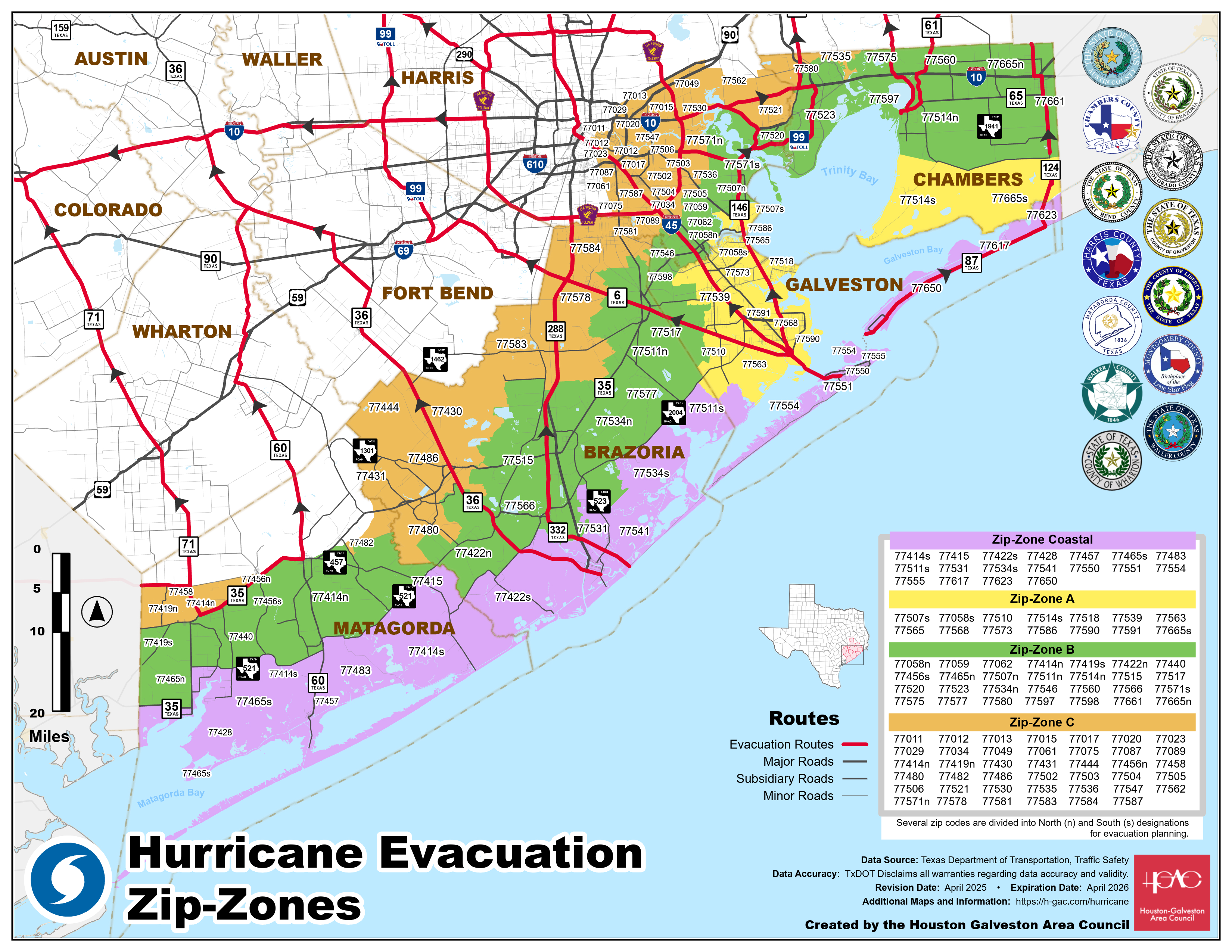
Click for a full size version of this map.
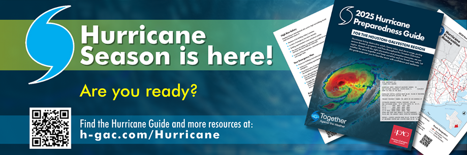
H-GAC also produces hurricane preparedness guides, ZIP zone evacuation maps, and special planning resources for people with access and functional needs, so every resident in the Gulf Coast region has access to lifesaving information.
Resources to Help You Stay Ready
As forecasters predict more intense and frequent storms this season, it’s more important than ever to know when and how to evacuate. You can find updated evacuation maps, preparedness guides, and resources for families, seniors, and individuals with special needs at h-gac.com/hurricane.