Ready to Elevate Your Project?
Connect with us today to explore how our lidar and elevation data can enhance your project.
LiDAR Uses & Applications


What is LiDAR?
LiDAR (Light Detection and Ranging) uses lasers for accurate 3D measurements:
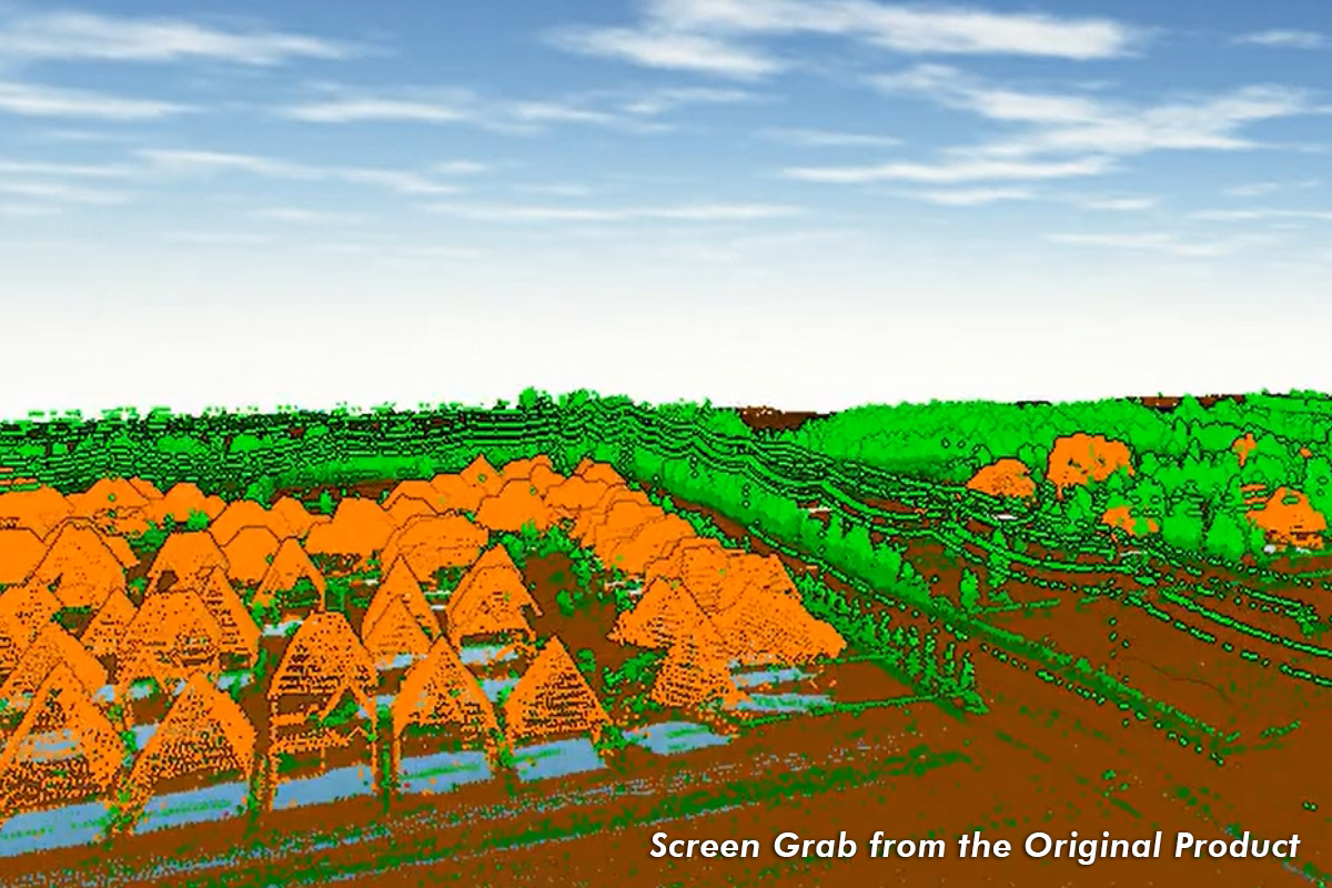
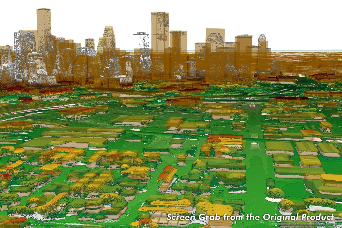
![]() Terrain Models: LiDAR-derived DSM/DEM Generation with Tailored Outputs
Terrain Models: LiDAR-derived DSM/DEM Generation with Tailored Outputs
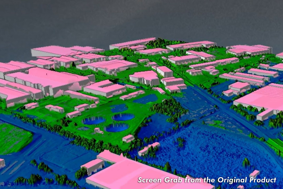
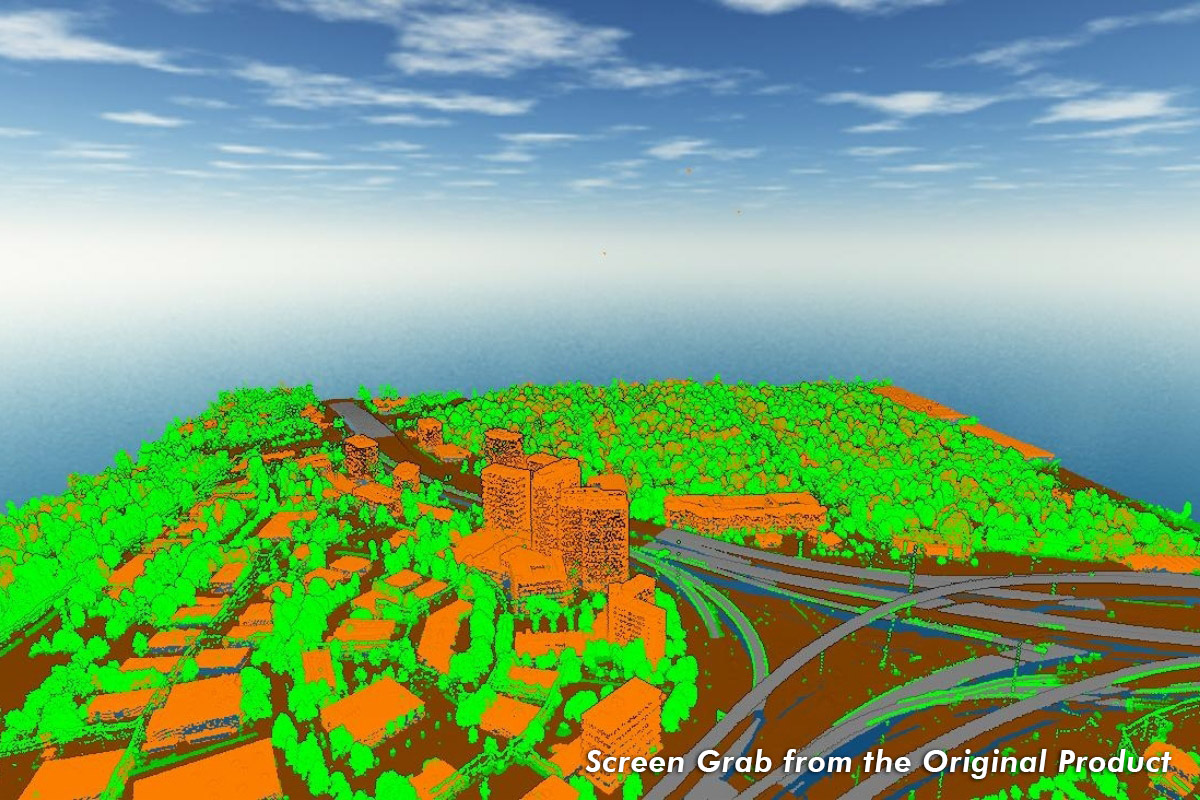
![]() ASPRS LAS 1.4: Enhances point classification and memory efficiency
ASPRS LAS 1.4: Enhances point classification and memory efficiency
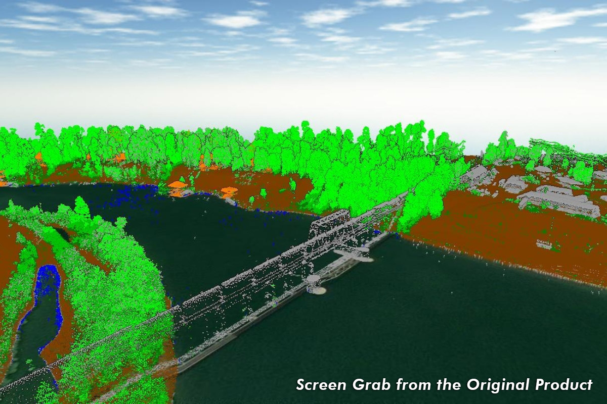
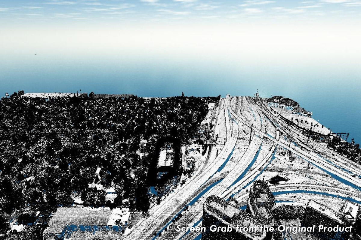
![]() Accurate and Discreet: Precise surface/object lidar point clouds, even from oblique angles
Accurate and Discreet: Precise surface/object lidar point clouds, even from oblique angles
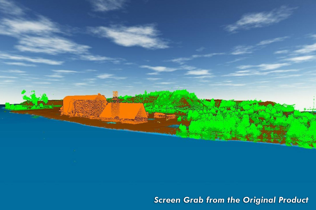
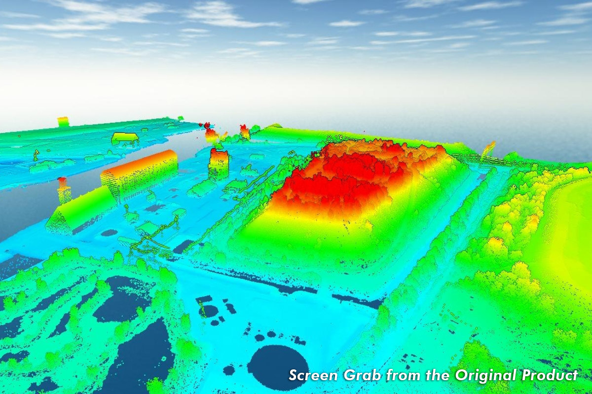
![]() 3D (X, Y, Z): Coordinates and point attributes (intensity, returns, classification) dictate density and accuracy
3D (X, Y, Z): Coordinates and point attributes (intensity, returns, classification) dictate density and accuracy
2024 LiDAR - Available Now
The 2024 LiDAR data is now available, providing high-resolution elevation information ideal for planning, flood analysis, and environmental monitoring.
LiDAR/Elevation Data Pricing
Current LiDAR/Elevation Data Pricing
| Product | Full Extent Price | 1 to 50 Tiles | 51 to 200 Tiles | 201 to 1,000 Tiles | 1,001 to 2,000 More Tiles | 2,001 or 5,000 Tiles | 5,001 or 10,000 Tiles | 10,001 or 15,000 Tiles | 15, 001 or More Tiles |
|---|---|---|---|---|---|---|---|---|---|
| 2024 LiDAR/Elevation Data 1 | Not Available | $100 per tile | $75 per tile | $50 per tile | $35 per tile | $25 per tile | $15 per tile | $10 per tiles | $5 per tiles |
Historical LiDAR/Elevation Data Pricing
| Product | Full Extent Price | Per Tile Price (1 to 25 Tiles) | Per Tile Price (26 or More Tiles) |
|---|---|---|---|
| 2018 LiDAR/Elevation Data - Harris County Flood Control District Extent | $4,000.00 | $200.00 | $125.00 |
| 2018 LiDAR/Elevation Data | $5,000.00 | $200.00 | $125.00 |
| 2014 LiDAR/Elevation Data | $2,000.00 | $100.00 | $100.00 |
| 2008 LiDAR/Elevation Data | $1,000.00 | $100.00 | $100.00 |
| 2006 LiDAR/Elevation Data | $500.00 | Not Available | Not Available |
Product Specifications and Deliverables
2006 LiDAR/Elevation Data
Product Specifications
Vertical Datums
NAVD88
Horizontal Datums
NAD83
Projections
UTM Zones 14 N and 15 N
Vertical Units
Meters
Horizontal Units
Meters
Accuracy
RMSEz 18cm
ASPRS Classifications
1-2
Acquisition
Sanborn Mapping Company
Product Deliverables
Mosaicked DEMMetadata
2008 LiDAR/Elevation Data
Product Specifications
Vertical Datums
NAVD88, 2001 Adjustment, GEOID99
Horizontal Datums
NAD83, HARN
Projections
State Plane Texas South Central (ftUS)
Vertical Units
US Feet
Horizontal Units
US Feet
Point Density
1 ppsm
Accuracy
RMSEz 9.25cm
ASPRS Classifications
1-2, 9
Acquisition
Merrick & Company
Product Deliverables
LAS Point Cloud (LAS 1.1)DEM (1m)
DSM (1m)
Hillshades
3D Breaklines
1ft and 5ft contour data
Metadata
2014 LiDAR/Elevation Data
Product Specifications
Vertical Datums
NAVD88, GEOID12A
Horizontal Datums
NAD83 (2011)
Projections
State Plane Texas South Central (ftUS)
Vertical Units
US Feet
Horizontal Units
US Feet
Accuracy
RMSEz X 1.9600 (95% confidence level)
ASPRS Classifications
1-7, 9, 13-14
Acquisition
Fugro
Product Deliverables
LAS Point Cloud (LAS 1.2)Hydro-flattened DEM (1m and 5m)
Hydro-breaklines
Intensity images
5ft contour data
Building footprints
File level metadata
2018 LiDAR/Elevation Data (Full Extent)
Product Specifications
Vertical Datums
NAVD88, GEOID12B
Horizontal Datums
NAD83 (2011)
Projections
UTM Zone 15 N (portion falls within UTM Zone 14 N)
Vertical Units
Meters (Orthometric, NAVD88)
Horizontal Units
Meters
Nominal Pulse Spacing
≤ 0.5m/4 ppsm
Accuracy
RMSEz 10cm (non-vegetated)
ASPRS Classifications
1-7, 9-10, 13-14
Acquisition
Fugro
Product Deliverables
LAS Point Cloud (LAS 1.4)Hydro-flattened DEM
Hydro-breaklines
Intensity images
2ft and 5ft contour data
Building footprint data
Boundary and tile layouts
File level metadata
3rd party QAQC report
2018 LiDAR/Elevation Data (Harris County Flood Control District Extent)
Product Specifications
Vertical Datums
NAVD88, GEOID12B
Horizontal Datums
NAD83 (2011)
Projections
State Plane Texas South Central (ftUS)
Vertical Units
US Feet
Horizontal Units
US Feet
Nominal Pulse Spacing
≤ 0.5m/4 ppsm
Accuracy
RMSEz 10cm (non-vegetated)
ASPRS Classifications
1-7, 9-10, 13-14
Acquisition
Fugro
Product Deliverables
Hydro-flattened DEM
Hydro-breaklines
File level metadata
Discover How Different Industries Use LiDAR Technology:

Virtual and Augmented Reality

Elevation Modeling, Aspect, and Slope Analysis

Forestry and Timber Management

Surface and Ground Feature Extraction

Utility and Energy Applications

Floodplain Management
LiDAR/Elevation Data Disclaimers
These products, data, and/or tools are for informational purposes only and may not have been prepared for or be suitable for legal, engineering, or surveying purposes. They do not represent an on-the-ground survey and represent only the approximate relative location of property boundaries. Mapping may not reflect on the ground conditions. The Houston-Galveston Area Council makes no further claims as to the accuracy or reliability of the data, and neither assumes, nor will accept liability for their use. Use or reproduction of this data without acknowledging the Houston-Galveston Area Council as the source is strictly prohibited.
The Houston-Galveston Area Council will not provide refunds once data has been delivered or shipped to customer. All sales are final once shipped or provided via delivery or FTP.
The Houston-Galveston Area Council does not provide prior purchased data as a restoration for lost or corrupted data previously purchases. Customers should ensure that all data is properly backed up and stored to prevent loss of data.
Pricing
Pricing and availability listed on this website are subject to change, and do not constitute any contractual commitment until an order has been placed via our online ordering system.