On This Page
Have you ever wondered what zip code most people work in within the Houston-Galveston region, or what county most workers live in and commute from?
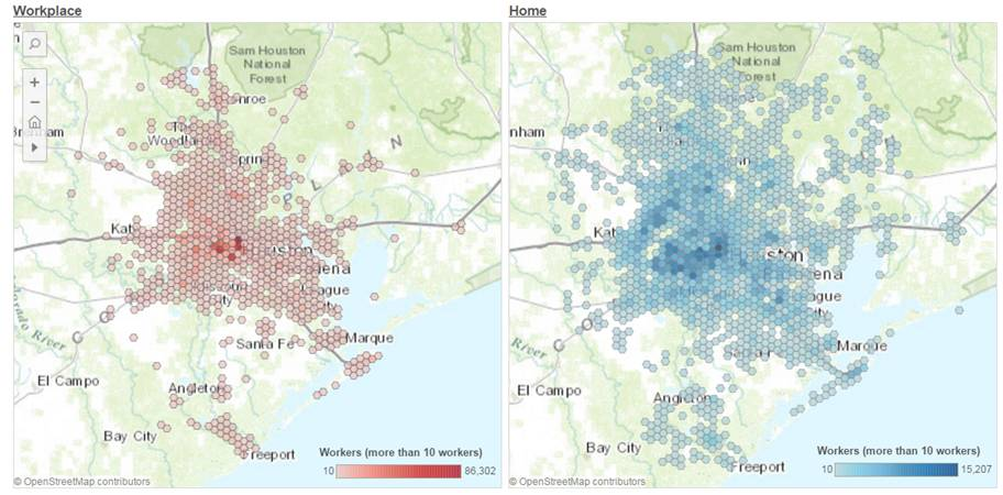
These interactive applications visualize workers' commuting patterns between home and workplace in different geographic levels in the region. The data is based on 2014 US Census Longitudinal Employer-Household Dynamics (LEHD) Origin-Destination Employment Statistics data.
Click/tap on the screenshots to launch the application.
Hexagonal Grids (3 sq. mile)
Regional Sectors
Commuting patterns based on the division of the Houston-Galveston region into 25 different sectors.
Counties
Commuting patterns based on the 13 counties that make up the Houston-Galveston region.
Zip Codes
Commuting patterns based on the zip codes contained within the Houston-Galveston region.
Census Tracts
Commuting patterns of the Houston-Galveston region based on census tracts.


