Access Ortho-Imagery
Make data-driven decisions confidently with our ortho-imagery. Its high resolution provides unprecedented detail and clarity, enabling precise measurements, enhanced feature recognition, and more confident decisions across diverse applications.
Aerial Imagery Uses & Applications

Engineering & Design
Plan roadways, subdivisions, and industrial sites.

Environmental Planning
Support sustainability and conservation efforts.

Change Detection
Track new developments and building footprints.

Asset Location & Feature Extraction
Identify canopy cover, impervious surfaces, and key assets.

Cartographic Visualization
Create clear, detailed maps.
2024 Aerial Imagery Now Available
The 2024 Aerial Imagery program is complete and ready for distribution. Perfect for urban planning, environmental analysis, and infrastructure management.
This high-quality imagery features:
![]() 6-inch and 12-inch resolution
6-inch and 12-inch resolution
![]() Four bands (RGB and infrared)
Four bands (RGB and infrared)
![]() Coverage across our 13 counties
Coverage across our 13 counties
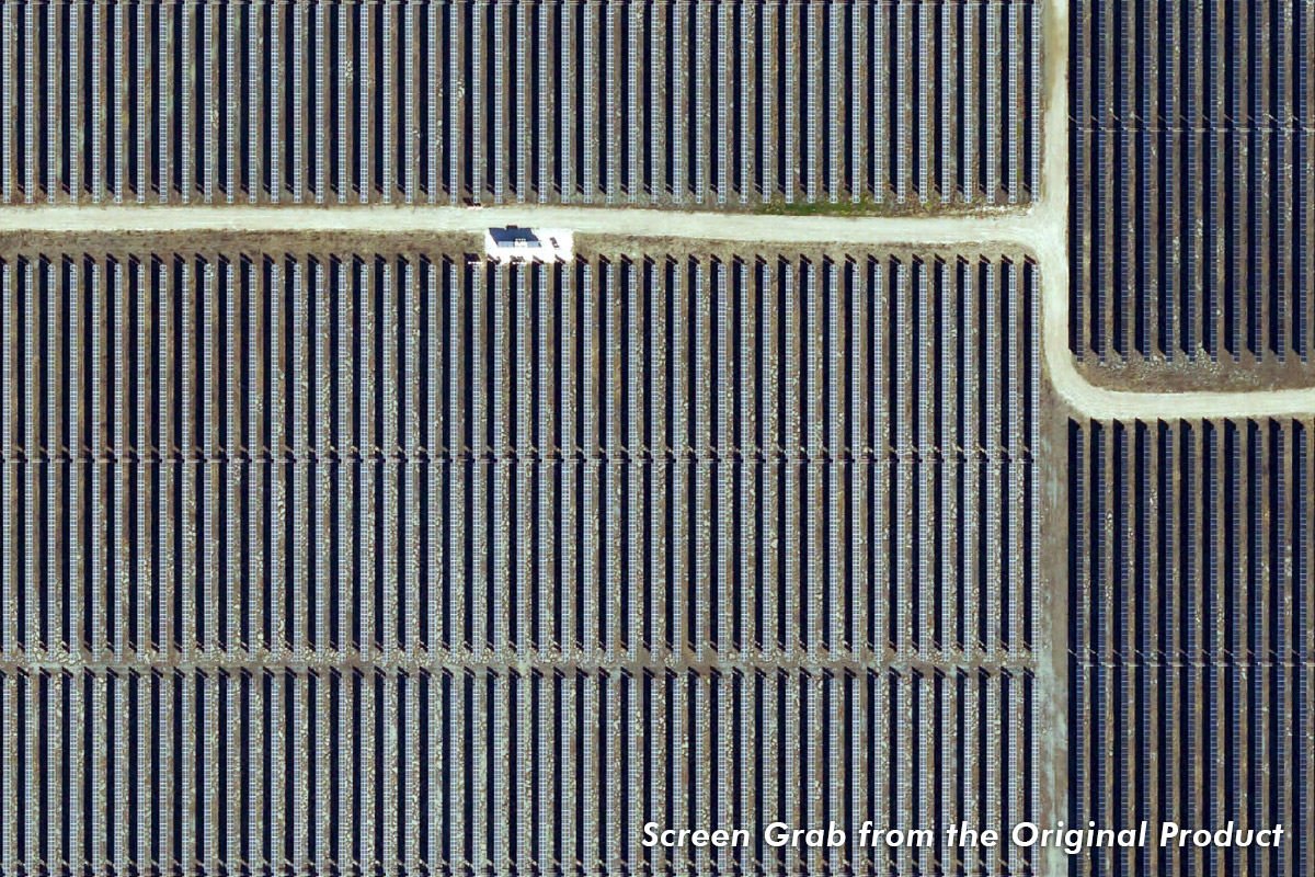
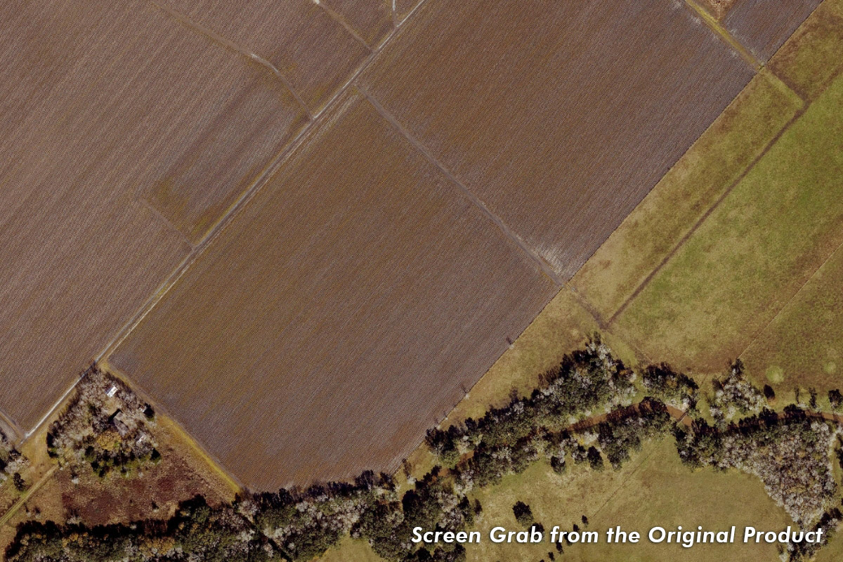
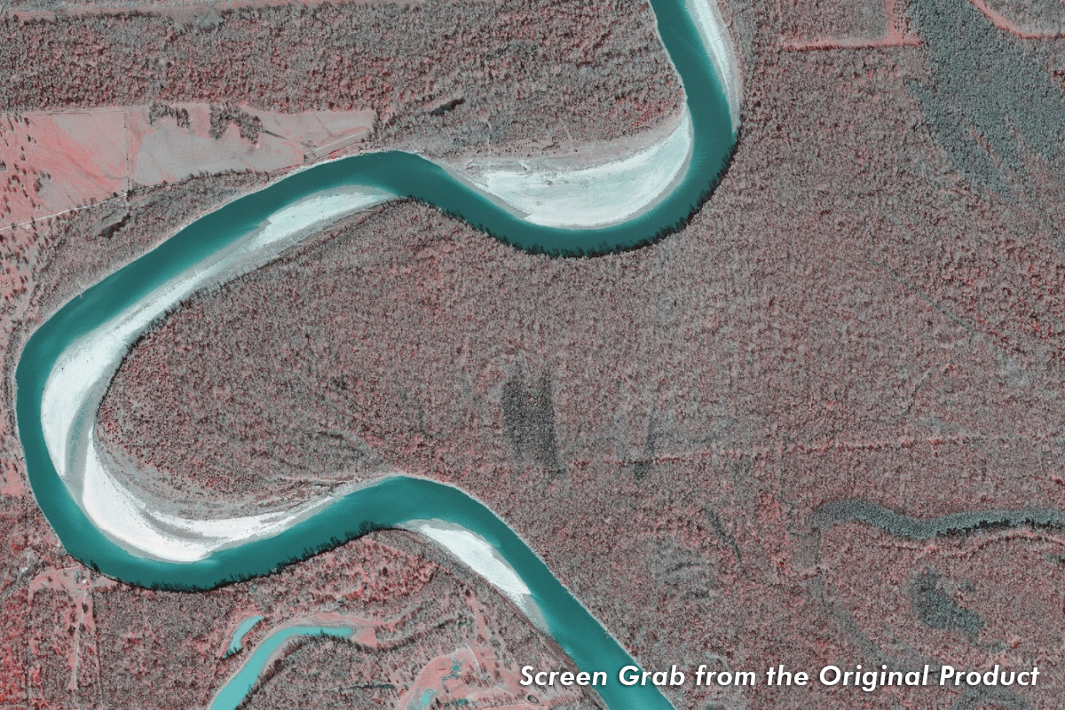
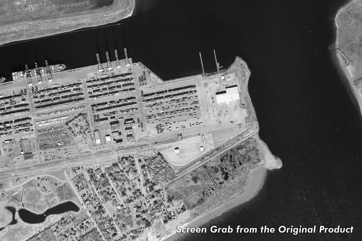
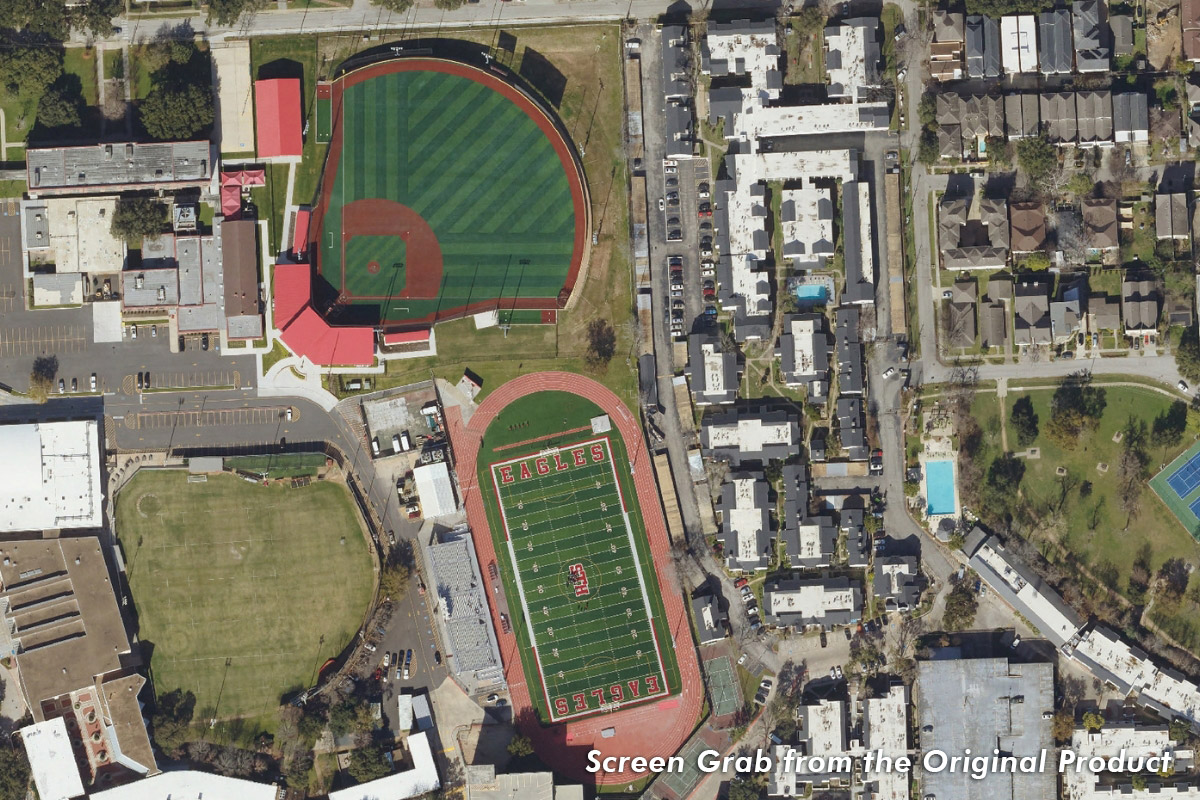
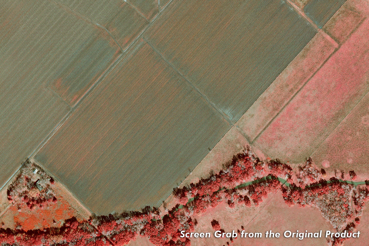
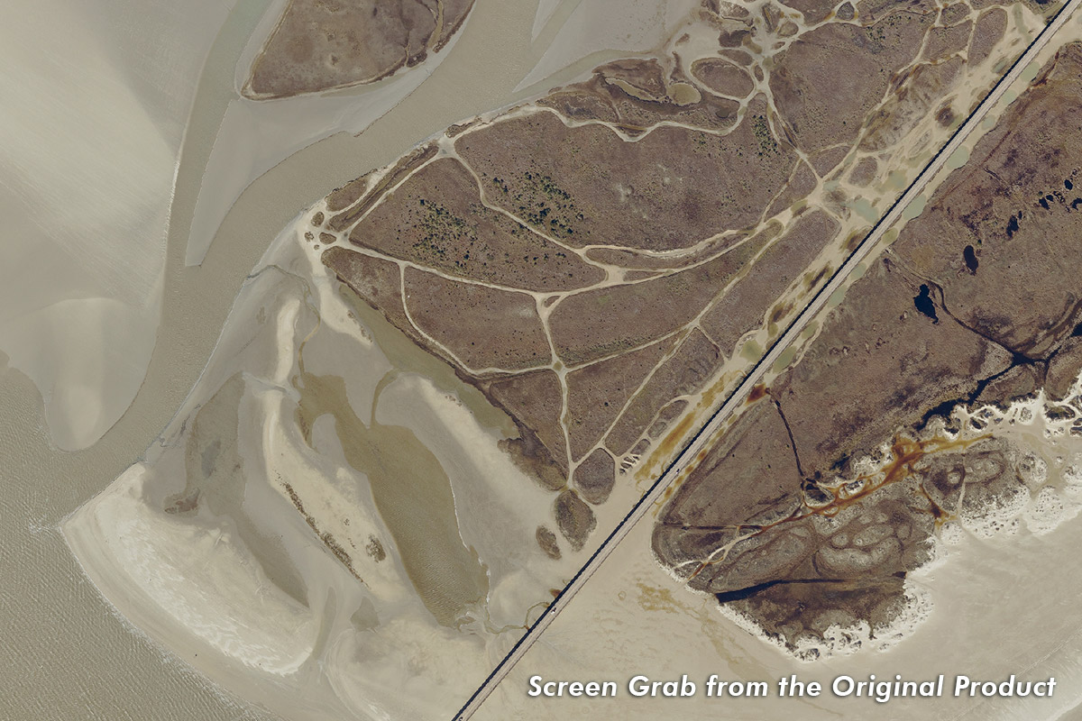
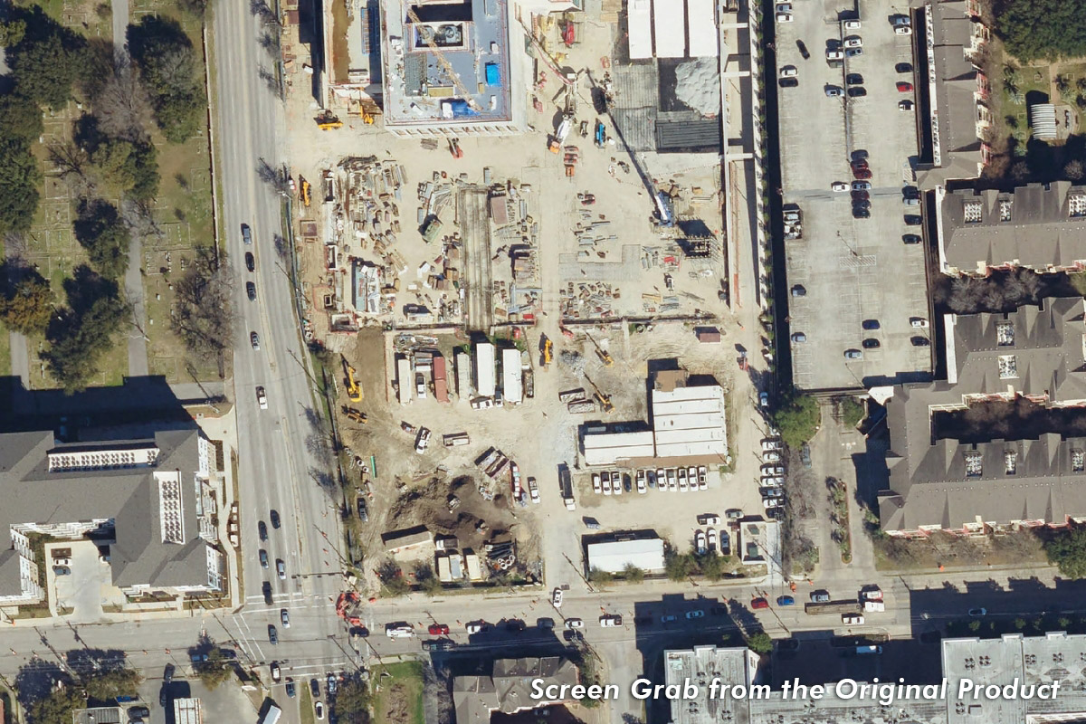
Imagery Grab Examples
NOTE: These Images Do Not Represent the Final Pixel Resolution
Aerial Imagery Pricing
1 Orders are typically delivered via FTP download or flash drive (included in price). Per tile orders Do Not include mosaics.
2 County-wide and full extent orders Do Not include mosaics. External storage used for delivery included in price.
3 Some counties only have partial coverage of this product. See coverage maps for details.
All aerial imagery data delivered in Mr. Sid format, no TIFFs are provided.
Pricing for Full Extent
For projects that require complete regional coverage, offering the most comprehensive data.
| 2024 Aerials Products | Full Extent 2 |
|---|---|
| 2024 6 Inch Resolution 4 Band (RGB+IR) | $60,000 |
| 2024 12 Inch Resolution 4 Band (RGB+IR) | $30,000 |
2 County-wide and full extent orders Do Not include mosaics. External storage used for delivery included in price.
All aerial imagery data delivered in Mr. Sid format, no TIFFs are provided.
Pricing by County
Perfect for larger projects that require imagery for entire counties.
| County 2 | 2024 Imagery Price |
|---|---|
| Austin County | $2,500 3 |
| Brazoria County | $15,000 3 |
| Chambers County | $10,000 3 |
| Colorado County | $5,000 3 |
| Fort Bend County | $10,000 3 |
| Galveston County | $10,000 3 |
| Harris County | $20,000 3 |
| County 2 | 2024 Imagery Price |
|---|---|
| Liberty County | $10,000 3 |
| Matagorda County | $7,500 3 |
| Montgomery County | $10,000 3 |
| Walker County | $5,000 3 |
| Waller County | $5,000 3 |
| Wharton County | $5,000 3 |
2 County-wide and full extent orders Do Not include mosaics. External storage used for delivery included in price.
3 Some counties only have partial coverage of this product. See coverage maps for details.
All aerial imagery data delivered in Mr. Sid format, no TIFFs are provided.
Pricing by Tile
Ideal for smaller, localized projects or specific areas of interest.
| 2024 Aerials Products | Tile 1 |
|---|---|
| 2024 6 Inch Resolution 4 Band (RGB+IR) | $500 |
| 2024 12 Inch Resolution 4 Band (RGB+IR) | $250 |
1 Orders are typically delivered via FTP download or flash drive (included in price). Per tile orders Do Not include mosaics.
All aerial imagery data delivered in Mr. Sid format, no TIFFs are provided.
Historical Aerial Imagery Pricing & Ordering
| Historical Aerials Products (link to coverage map) | Tile 1 | County 2 | Full Extent 2 |
|---|---|---|---|
| 2022 6 Inch Resolution Color (RGB) | $250 | $5,000/County 3 | $12,000 3 |
| 2022 6 Inch Resolution Infrared (CIR) | $250 | $5,000/County 3 | $12,000 3 |
| 2020 6 Inch Resolution-Natural Color (RGB) | $250 | $5,000/County 3 | $12,000 3 |
| 2020 6 Inch Resolution-Color Infrared (CIR) | $250 | $5,000/County 3 | $12,000 3 |
| 2020 12 Inch Resolution-Natural Color (RGB) | $250 | $5,000/County 3 | $12,000 3 |
| 2018 Aerials 6 Inch | $150 | $1,500/County 3 | $4,500 3 |
| 2018 CIR 6 Inch | $150 | $1,500/County 3 | $4,500 3 |
| 2018 Aerials 1 Foot (Rural Counties) | $150 | $1,500/County 3 | $4,500 3 |
| 2018 CIR 1 Foot (Rural Counties) | $150 | $1,500/County 3 | $4,500 3 |
| 2017 Post-Harvey Aerials 1 Foot | N/A | N/A | $250 |
| 2017 Post-Harvey CIR 1 Foot | N/A | N/A | $250 |
| 2016 Aerials 6 Inch | $200/Tile | $2,000/County 3 | $9,500 3 |
| 2016 CIR 6 Inch | $200/Tile | $2,000/County 3 | $9,500 3 |
| 2015 Aerials 1 Foot (Rural Counties) | $150/Tile | $1,500/County 3 | $3,200 3 |
| 2015 CIR 1 Foot (Rural Counties) | $150/Tile | $1,500/County 3 | $3,200 3 |
| 2014 Aerials 1 Foot | $100/Tile | $1,000/County 3 | $5,500 3 |
| 2014 Aerials 6 inch | $150/Tile | $1,500/County 3 | $6,500 3 |
| 2014 CIR 1 Foot | $100/Tile | $1,000/County 3 | $5,500 3 |
| 2012 Aerials 1 Foot | $50/Tile | $1,000/County | $5,500 |
| 2012 Aerials 6 Inch | $75/Tile | Not Available 3 | $1,200 3 |
| 2010 Aerials 1 Foot | $50/Tile | $1,000/County 3 | $5,500 3 |
| 2010 Aerials 6 Inch | $75/Tile | Not Available 3 | $1,200 3 |
| 2008 Aerials 1 Foot | $50/Tile | $1,000/County 3 | $5,500 3 |
| 2008 Aerials 6 Inch | $75/Tile | Not Available 3 | $600 3 |
| 2006 Aerials 1 Foot | $50/Tile | $1,000/County 3 | $5,500 3 |
| 2006 Aerials 6 Inch | $75/Tile | Not Available 3 | $600 3 |
| 2004 Aerials 1 Foot | $50/Tile | $1,000/County 3 | $5,500 3 |
| 2002 Aerials 1 Foot | $50/Tile | $1,000/County 3 | $5,500 3 |
| 2001 Aerials 1 Foot | $50/Tile | $1,000/County 3 | $5,500 3 |
| 2000 Aerials 1 Foot | $50/Tile | $1,000/County 3 | $5,500 3 |
1 Orders are typically delivered via FTP download or flash drive (included in price). Per tile orders Do Not include mosaics.
2 County-wide and full extent orders Do Not include mosaics. External storage used for delivery included in price.
3 Some counties only have partial coverage of this product. See coverage maps for details.
All aerial imagery data delivered in Mr. Sid format, no TIFFs are provided.
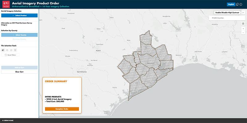
Select and Purchase Aerial Imagery Products
View aerial coverage by project year and select the tiles you wish to purchase.
About the Aerial Ortho-Imagery Program
The Houston-Galveston Area Council (H-GAC) has been collecting high-resolution aerial imagery to fuel regional growth and development. Imagery is captured biannually to provide up-to-date data for urban planning, environmental monitoring, and infrastructure management.
Program Highlights
![]() High-Resolution Ortho-Imagery: 6-inch and 12-inch resolution in natural color (RGB) and color-infrared.
High-Resolution Ortho-Imagery: 6-inch and 12-inch resolution in natural color (RGB) and color-infrared.
![]() Flexible Access: Purchase by tile, county or full coverage.
Flexible Access: Purchase by tile, county or full coverage.
![]() 25 Years of Data: Historical imagery from 2000 to present.
25 Years of Data: Historical imagery from 2000 to present.
![]() Biannual Updates: Always current, always accurate.
Biannual Updates: Always current, always accurate.
You're In Good Company—Imagery Uses Include:

Urban Development

Business Logistics

Marketing & Property Analysis

Mapping & GIS Applications

Emergency Management
H-GAC Aerial Ortho-Imagery Disclaimers
These products, data, and/or tools are for informational purposes only and may not have been prepared for or be suitable for legal, engineering, or surveying purposes.
They do not represent an on-the-ground survey and represent only the approximate relative location of property boundaries. Mapping may not reflect on the ground conditions.
The Houston-Galveston Area Council makes no further claims as to the accuracy or reliability of the data, and neither assumes, nor will accept liability for their use.
Use or reproduction of this data without acknowledging the Houston-Galveston Area Council as the source is strictly prohibited.
The Houston-Galveston Area Council will not provide refunds once data has been delivered or shipped to customer. All sales are final once shipped or provided via in-person delivery or via FTP.
The Houston-Galveston Area Council does not provide prior purchased data as a restoration for lost or corrupted data previously purchased. Customers should ensure that all data is properly backed up and stored to prevent loss of data.
Pricing
Pricing and availability listed on this website are subject to change, and do not constitute any contractual commitment until an order has been placed via our online ordering system.
Imagery Grab Examples
NOTE: These Images Do Not Represent the Final Pixel Resolution