
On This Page
Study Summary and Goals
The Spring Branch Study provides analysis and recommendations for transportation and land use investments that create a more walkable, connected community. Specifically, the study recommends:
- Initiating a pilot project to reduce the number of lanes on Long Point Road to create more room for public improvements in the right of way like wider sidewalks, wayfinding, and bicycle facilities.
- Developing a set of character standards for Long Point Road to encourage “Main Street” style development and redevelopment.
- Expanding and improving open space within the community through investments in the CenterPoint Trail and Haden Park.
Study Area Map
The focus of the Spring Branch Livable Center study is the Long Point Corridor from approximately Gessner on the west to Highway 290 on the east. The Long Point corridor is the traditional ‘Main Street’ of the Spring Branch community. It contains a mix of uses and is beginning to undergo some redevelopment
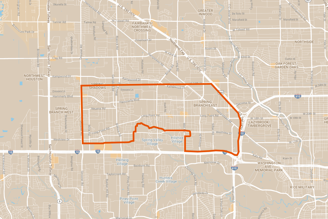
Click for a full size version of this map.
Local Partners
Spring Branch Management District
Lead Consultant
SWA