On This Page
Study Summary and Goals
The Museum Park Study provides analysis and recommendations for land use and infrastructure investments that create a more walkable, connected neighborhood to serve the residents and visitors to the area’s major regional destinations. Specifically, the study recommends:
- Investing in pedestrian and bicycle connections in the neighborhood through a Culture Trail, streetscape improvements on Caroline Street, and linear greenspace that extends from the parks through the neighborhoods to create a green grid.
- Developing plans for transit-oriented development around the Wheeler Transit Center and a park over US-59 to better connect Museum Park to Midtown and Downtown to the north.
- Promoting the neighborhood’s many destinations through a new marketing/branding campaign and an “Art of Walking” branding program that incorporates wayfinding and public art.
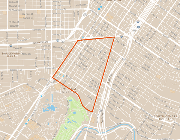
Study Area Map
The study area is generally bounded by Main Street, US- 59, Almeda Road, and Hermann Park in the City of Houston.
Click for a full size version of this map.
Local Partners
Museum Park Super Neighborhood
Houston Southeast
Lead Consultant
SWA Group


