On This Page
Study Summary and Goals
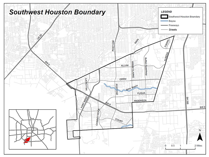
The study area covers 25 square miles and is located south of Loop 610, bordered on the north by Main Street, to the south by McHard Road, to the east by Almeda Road, and the west by Fondren Road. The area contains a mixture of land uses including residential neighborhoods, commercial corridors, industrial establishments, and undeveloped land.
Over the last decade, the area has experienced increased development of a variety of uses including single-family residential, low income multi-family residential, and light industrial uses. This rapid development is suburban in character, however, and has occurred without guidance and consideration of the mobility needs to serve the population.
The study area is bisected by Brays Bayou and includes 3 commercial corridors with significant opportunity for development and redevelopment, Sims Bayou Greenway, and a number of community parks including Townwood Park and Community Center, Brentwood Park and the planned Blue Ridge Park owned by Harris County. Houston METRO’s possible light rail line extension from Fannis South Station, the Wildcat Golf Course - a reclaimed municipal landfill, and the Willow Water Hole regional park provide unique opportunities for multimodal growth and connectivity in the study area. Sims Bayou trail is also under development and opportunity of expansion with a CenterPoint utility easement is identified as a key north-south connector on the Houston Bike Plan.
Download the Southwest Livable Centers Study
Study Area Map
Click for a full size version of this map.
Local Partner
City of Houston
Lead Consultant
Halff Associates


