
Access the Power of Detailed Regional Data with STAR*Map
Sign up to receive detailed address points, road centerlines, and ZIP code data across the 13-county region with an annual membership (including monthly updates) or a one-time data set purchase.
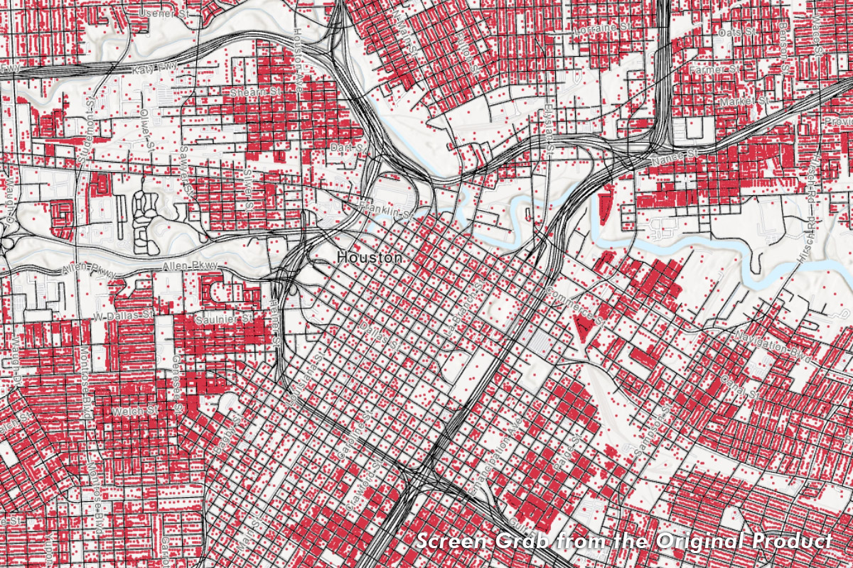
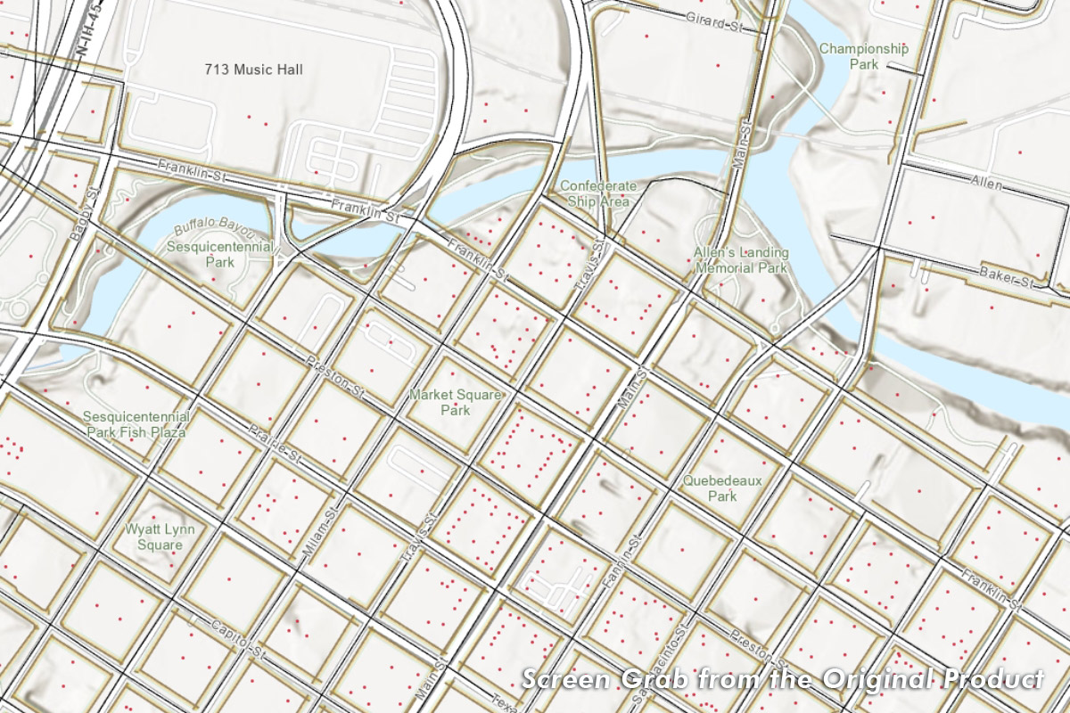
2.6+ M Address Points
About 12,500 address points updated monthly.
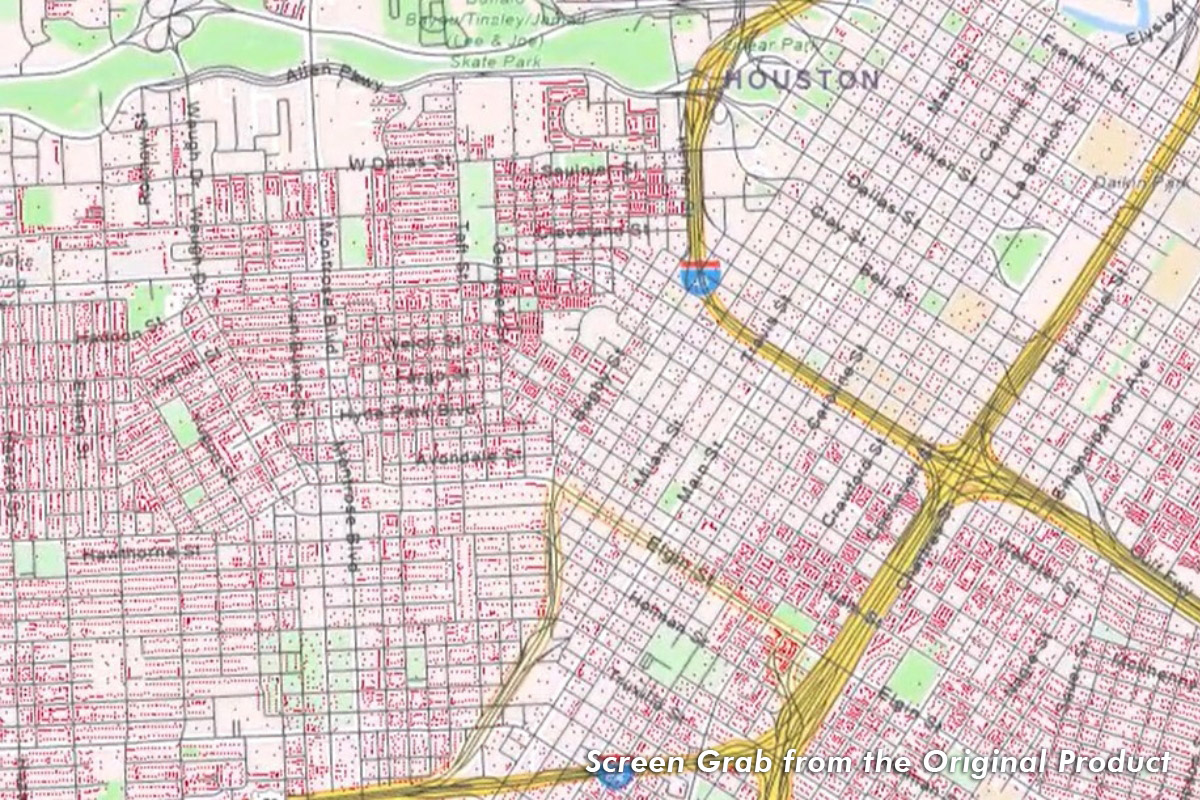
400+ K Roadway / Street Centerlines & 21+ K Sidewalks
About 200 street centerline miles updated monthly. Includes street names, address range, left-to-right travel paths.
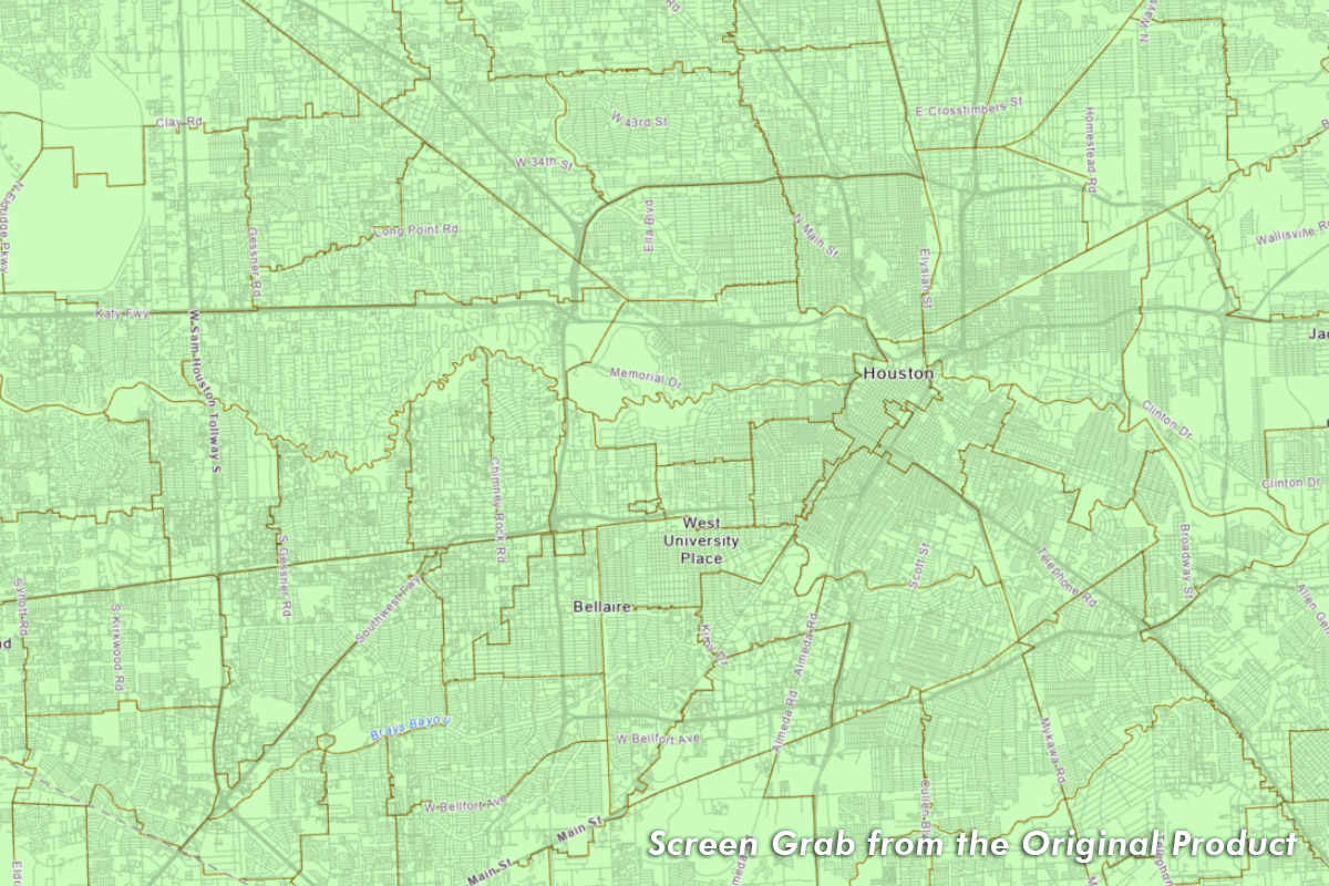
250+ ZIP Codes
About 261 polygon ZIP codes. (Updated Monthly)
STAR*Map: What's In It For You?
![]()
Updates released monthly
![]()
Easily search H-GAC’s addresses and localities, and visualize them on a highly accurate map
![]()
Multi-county region, including 13 counties in Houston area
![]()
National Emergency Number Association (NENA) Next Generation (NG) 911 standard schema
![]()
Geocoding-ready data for seamless location integration
About STAR*Map
The Southeast Texas Addressing and Referencing Map (STAR*Map) is a trademarked digital database managed by the Houston-Galveston Area Council (H-GAC), providing:
![]() Comprehensive Coverage: Includes all of Harris, Fort Bend, Brazoria, Liberty, Montgomery, Galveston, Wharton, Waller, Austin, Chambers, Colorado, Matagorda, and Walker Counties.
Comprehensive Coverage: Includes all of Harris, Fort Bend, Brazoria, Liberty, Montgomery, Galveston, Wharton, Waller, Austin, Chambers, Colorado, Matagorda, and Walker Counties.
![]() Detailed Data: Offers address points, road centerlines, and ZIP code information.
Detailed Data: Offers address points, road centerlines, and ZIP code information.
![]() Versatile Formats: Available in ArcGIS File Geodatabase (FGDB) and shapefile formats.
Versatile Formats: Available in ArcGIS File Geodatabase (FGDB) and shapefile formats.
![]() Rich Attributes: Features block addresses, street names, and street types.
Rich Attributes: Features block addresses, street names, and street types.
Ideal for planners, developers, and GIS professionals, STAR*Map is an essential tool for addressing and referencing needs in the region.
STAR*Map Status Report
STAR*Map is released monthly. The latest release was generated on July 20, 2026.
STAR*Map includes 2,696,526 address points, 467,079 roadway centerlines, 262 zipcodes and roughly 22,922 miles of sidewalks for this release. The service has been updated to reflect this release.
STAR*Map Packages & Pricing
Get the Right License for Your Needs
Annual Subscription Plans
Starting at $3,500
Choose your geography tier and update frequency.
| Tier 1 – Very Small | STAR*Map Price |
|---|---|
| Population < 10K | |
| Quarterly updates | $3,500/year |
| Monthly updates | $5,000/year |
| Tier 2 – Small | STAR*Map Price |
| Population 10K to 50K | |
| Quarterly updates | $6,000/year |
| Monthly updates | $8,000/year |
| Tier 3 – Medium | STAR*Map Price |
| Population 50K to 250K | |
| Quarterly updates | $9,000/year |
| Monthly updates | $12,000/year |
| Tier 4 – Large | STAR*Map Price |
| Population > 250K | |
| Quarterly updates | $12,000/year |
| Monthly updates | $18,000/year |
📌 Monthly = 12 updates/year | Quarterly = 4 updates/year
📦 All subscriptions include customer support, version control, and access to update archives.
One-Time Dataset Purchase
Starting at $1,800
Select your own data by geography tier.
| Tier 1 – Very Small | STAR*Map Price |
|---|---|
| Population < 10K | |
| One-time purchase | $1,800 |
| Tier 2 – Small | STAR*Map Price |
| Population 10K to 50K | |
| One-time purchase | $2,500 |
| Tier 3 – Medium | STAR*Map Price |
| Population 50K to 250K | |
| One-time purchase | $3,000 |
| Tier 4 – Large | STAR*Map Price |
| Population > 250K | |
| One-time purchase | $4,000 |
***One-time purchase (regardless of population size) contains updated address points, roadway centerlines, and ZIP codes***
- One-time purchases include current data only — no access to updates or support.
- Add-on updates within 6 months available at 50% of one-time rate.
- Education and research institutes receive a 50% discount.
You're in Good Company—STAR*Map Use Cases Include:

Urban Development

Business Logistics

Marketing & Property Analysis

Mapping & GIS Applications

Emergency Management
STAR*Map Disclaimer
The maps and data presented herein are intended for general reference only. The Houston-Galveston Area Council makes no claim as to its accuracy and neither assumes nor will accept liability for its use. STAR*Map is a registered trademark of the Houston-Galveston Area Council and the Geographic Data Workgroup. They require use of the trademark with the map product, for three reasons:
- To protect against re-packaging of this public data for resale as a proprietary product.
- To advise the public of the source of the data.
- To acknowledge the labor of the contributors who make STAR*Map possible.
Pricing and availability listed on this website are subject to change, and do not constitute any contractual commitment until an order has been placed via our online ordering system. Furthermore, H-GAC does not make any service level agreement guarantees on availability of online map services that may be affiliated with this product.
These products, data, and/or tools are for informational purposes only and may not have been prepared for or be suitable for legal, engineering, or surveying purposes. They do not represent an on-the-ground survey and represent only the approximate relative location of property boundaries. Mapping may not reflect on the ground conditions. The Houston-Galveston Area Council makes no further claims as to the accuracy or reliability of the data, and neither assumes, nor will accept liability for their use. Use or reproduction of this data without acknowledging the Houston-Galveston Area Council as the source is strictly prohibited.
The Houston-Galveston Area Council will not provide refunds once data has been delivered or shipped to customer. All sales are final once shipped or provided via delivery or FTP.
The Houston-Galveston Area Council does not provide prior purchased data as a restoration for lost or corrupted data previously purchases. Customers should ensure that all data is properly backed up and stored to prevent loss of data.