
On This Page
Study Summary and Goals
The overall goal of the study is to create a Livable Centers plan for the study area that will define new, context-sensitive standards for the East End District that foster multi-modal access and connectivity, a mix of land uses, a diversity of housing options, and a sense of place.
The study’s conceptual plan and recommended catalyst projects should encourage walkability, connection within and between nodes of community activity, and built environment strategies that support local economic development and employment. The study should result in a forward-looking vision and practical implementation strategies that consider responsible stewardship of the East End District’s existing resources to best meet anticipated population growth.
Download the Greater Eastwood Livable Centers Planning Study
Download the Greater Eastwood Livable Centers Planning Study Summary
Study Area Map
The Eastwood Livable Center Study will focus on the area roughly bounded by Harrisburg Blvd on the north, Wayside on the east, I-45 Gulf Freeway on the south, and Scott on the west, with a few blocks buffer to each of the boundary roads.
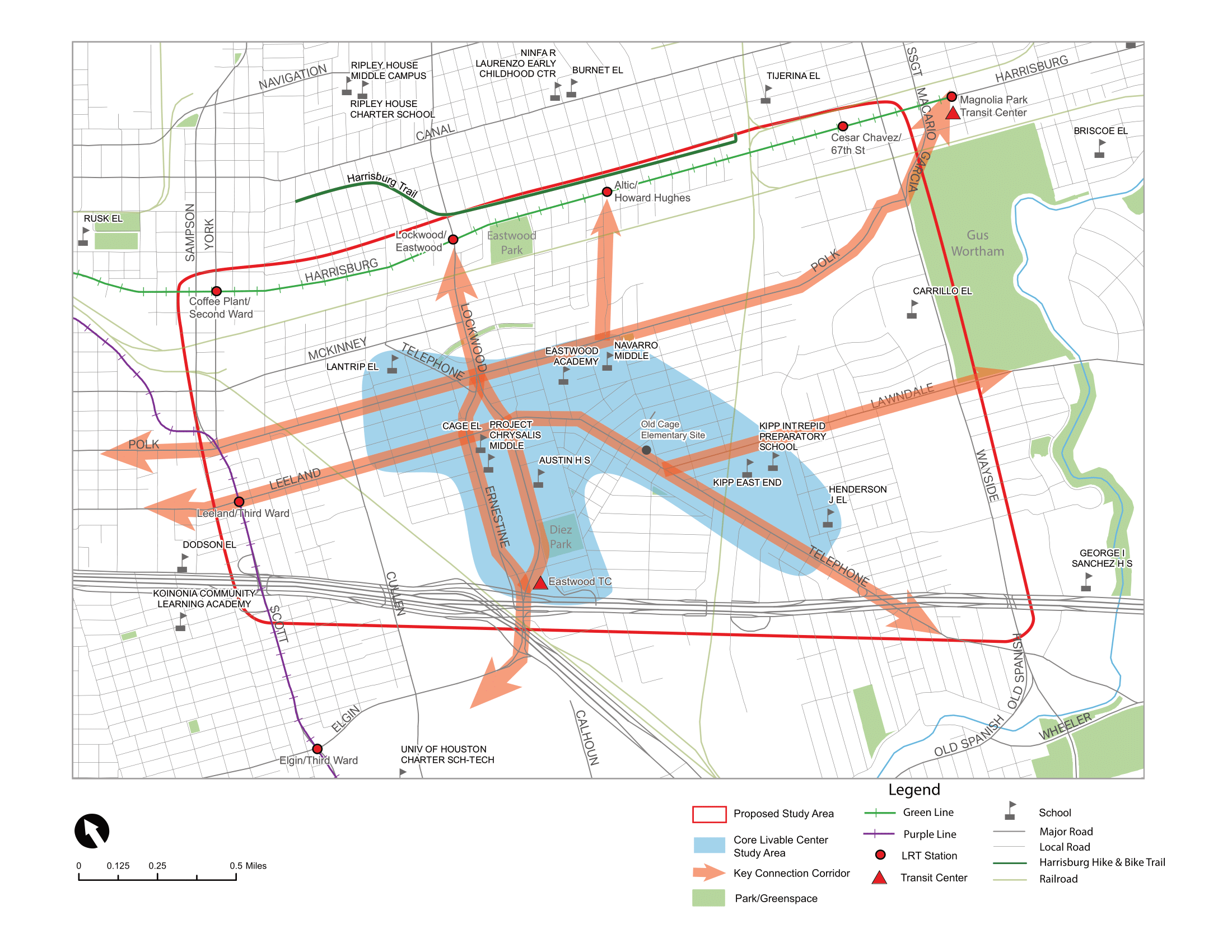
Click for a larger image.
Local Partners
East End Management District
Lead Consultant
Traffic Engineers, Inc. (TEI)